Magny Le Désert
Signposting M < download the sheet >

Duration : 2h30 -
Distance : 7,5 Km -
Height range : 101 m -
Bridlepaths : 95% -
Marked footpaths : Yes -
Difficulties : Average -
Good walking shoes required.
Partly over rocky ground and some steep gradients.
Sometimes slippery near the river.
For information on hunting :
National Forestry Office on 02 33 37 25 64
< Jours chassés en Normandie >
Major's office : 02 33 37 11 91
open Monday to Friday 9.00 am to 12.30 pm, and 1.30 pm to 5.00 pm.
description


- Departure point: the "Vallée de la Cour" car park.
Turn right out of the car park.
Walk along beside the lake.
Cross the road and take the small path opposite.
Follow the GR (long-distance footpath) as far as the intersection. - Take the largest of the paths opposite. Follow ‘Gorges de Villiers’.
- On arriving beside plot number 57, leave the ‘Gorges de Villiers’ path, and follow the yellow signposts, taking the pathway to your left as far as the ‘Patte d’Oie’ intersection.
- At this intersection, take the major Patte d’Oie pathway to the right.
On arriving at the forest thoroughfare (at a copse which forms a roundabout), take the right-hand turning as far as St Anthony’s Chapel.
Walk along the left-hand side of the chapel as far as the fountain, and then retrace your steps. - Carry on along the more theoretical and sometimes slippery path which winds alongside the Gourbe stream.
At the gangway which hangs over the Gourbe, you can cross over to re-join the stony scree and to reach Fairy Gisèle’s Grotto (30 minutes there and back).
If you carried straight on for 10 metres, you would come to the ‘hot springs’. - Return to the gangway, turn left and then immediately right, following the yellow and red-and-white GR signposts.
The path here is steep.
Under the conifers, before you leave this plot, bear right following the same signposts.
Continue to the right, taking the GR pathway to the top of the Gorges. - On reaching the intersection of the two GRs, take the broad avenue to the left for 500 metres.
It becomes narrower, bears to the right, and leads back to the intersection from which you came.
Here you have two options.
Either follow the GR signposts to the departure point (the descent to the road can sometimes be slippery); or follow the yellow signposts to the road and turn left.
Return to the departure point.
Magny le Désert
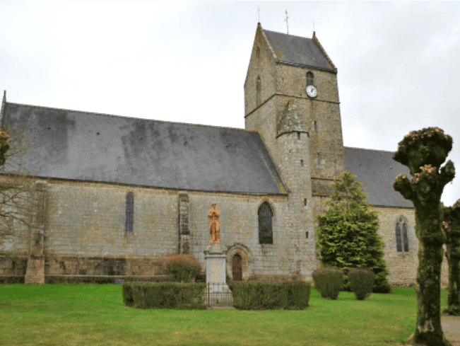
The name is of Romano-Gallic origin, the Magnius estate and Désert here combining to take on the meaning of ‘uncultivated land’.
Worth seeing in the village of Magny le Désert: a fine, imposing Romanesque church with some later modifications.
Gorges de villiers < Download the sheet >


In the Gorges de Villiers, you can observe the diverse nature of the natural environments that this area comprises: woodland, moorland, scree, peat bog, as well as the richness of its flora and fauna.
Legends such as that of the fairy Gisèle abound in this area.
From the ‘hot spring’, water gushes from the depths at 15 degrees all year round.
The qualities of these waters were already appreciated by the Romans.
The Gourbe
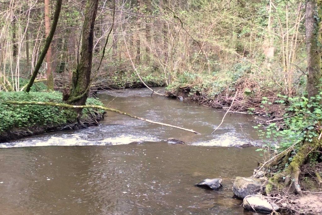

The Gourbe stream flows into the Mayenne river, after a journey of 24km.
In the early middle ages, the Andaines Forest formed part of a large tract of land which extended from Alençon to Domfront.
Nowadays it is divided into two tracts.
The first, which reaches from Domfront to Bagnoles de l’Orne, covers 4120 hectares.
The second, amounting to 1310 hectares, consists of the Magny woods and of the forests of La Ferté Macé and of La Motte, all to the east of Bagnoles.
Chaude Fontaine


Vallée de la cour


The ‘Vallée de la Cour’.
In this location was a textile mill and factory driven by steam and hydraulic power from 1864, when the water barrier was created.
Following their closure at the end of the nineteenth century, they were transformed into a glass factory, and then into a discotheque, and finally into gîtes.
Saint Antoine chapel

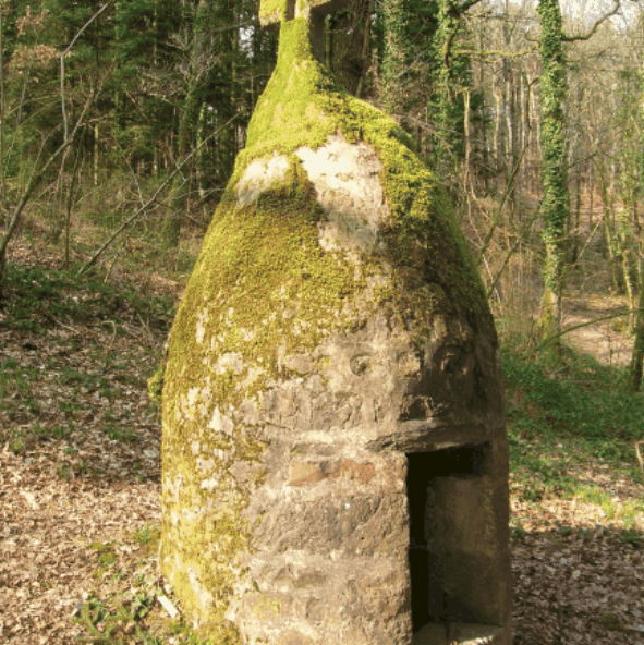


“A few kilometres from the centre of Magny, on land belonging to the village, in the heart of the forest, there stands the chapel dedicated to St Anthony the Great.
It would seem that, from the earliest centuries of the present era, this place was first the shelter of a single hermit…and it is practically certain that from the sixth century (and perhaps even earlier) a monastic community came and established itself on this secluded spot alongside the little Gourbe valley.
As to the no doubt rudimentary living conditions that greeted these first settlers, some evidence – consisting of a few foundation stones – can be found in the wooded land to the north…*
Near the chapel, the fountain is to be found.
An opening in its lower part allows the miraculous water, which must be drunk by the person seeking favours, to be drawn.
He must also fix to the inner rim of the fountain a wooden cross reflecting the level of his pain.”*
* Extract from an article published by the local authority of Magny le Désert under the auspices of the Association for the protection and restoration of the heritage of La Ferté Macé and its surrounding area.
Altimetric contour
