Les Monts d'Andaines - La Sauvagère
Signposting S < download the sheet >
Duration : 2h30 -
Distance : 8,8 Km -
Height range : 144 m -
Bridlepaths : 70% -
Marked footpaths : in progress -
Difficulties : none -
Les Monts d'Andaine was formed by combining the communes of La Sauvagere and St Maurice du Desert in 2015
Mairie : 02 33 37 21 81 ou 02 33 37 13 24
description


Leave from in front of the church at St Maurice du Désert.
Take the path on the left alongside the road to La Sauvagère.
Continue on the cemetery path to the crossroads where you turn left.Continue straight on to the hamlet of la Roculière (about 750m) (Pass by La Petite Roculière and the road leading to <<Cotis>>).
There is a viewpoint where you can see the village of La Coulonche.
At la Roculière, take the path on the right, then continue straight on the hollow lane which becomes a path.
This path crosses a stream named <<Ruisseau du Parc Galet>>
The path ends in the hamlet of Gestel where you turn left and continue on the tarred road ( about 1km) as far as the Carrefour du Chêne à la vierge where you turn right.
Continue on the surfaced road for about 750m.
At the stop sign, if you cross the road, (be careful), you can leave the walk to see l’étang de la Forge et la maison du maître de Forge. (private property).
Or else at the stop sign, turn right on the road towards La Sauvagère for about 10 mTake the hollow lane on the right for about 1.7 km...
The hollow lane becomes larger and stonier. (Where the path bends left, a hollow lane to the right is the beginning of an alternative route)As soon as you arrive at the surfaced path turn right and take a hollow lane. (Way marked PRNM).
Go straight on at the first group of modern houses.
At the end of the path, bear left on the tarred path.
Leave the carpark on your left and go straight.About 10 m before the stop sign turn right.
You can leave the walk here to explore La Sauvagère.
Leave the development <<Le Petit Mont>> on your right and take the path <<du Vieux Moulin>> on your right.
Continue on the tarred road which becomes stony.
Carry on until you come to a tarred road.At the stop sign, turn right and then immediately left on a path.
At the end of this path continue straight on beside St Maurice's football pitch.
Continue on the cemetery path to the car park.
Le bourg de La Sauvagère

St Maurice du Desert : the church and yew tree.
Inside the church the arches date from 1647.
Near the church, hidden behind the trees is a 17th century castle (private property).
Les Illuminations


The church is neogothic with a bell tower roof which dates from the 16th century.
The chapels are joined onto the nave by arches which start at the ground, probably from an earlier construction.
animations in la sauvagère

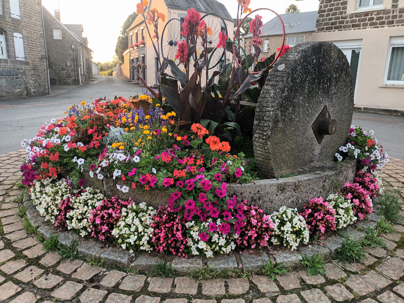
This village is well known for its floral displays and Christmas lights.
on the course


From the walk you can see the l’étang de la Forge.
It is interesting to cross the road for a better look.
L’étang de la Forge, on the river Vee, has been reduced by half since the time when it was used for hydraulic energy to power the forge at La Sauvagere.
On the left of the lake you can see a fine house which was where the 'Maitre de Forge' lived. (private property).
In the 15th et 16th century


In the 15th and 16th century our area had many large forges which used the iron found principally in the forest near the surface.
It was brought to the forge to be treated using the hydraulic energy harnessed by releasing the stored water and also the charcoal furnished by the wood from the forest.
There were 3 stages of production : The high furnace which gave <<gueuses>>, bars of pig iron, the forge which had a big hammer where the iron was worked and the <<fenderie>> where the bars of pig iron were cut up.
The iron was then sent to the Chanu area where it was used mainly for nails but also for locks and ironmongery.
Out of course
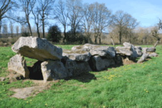
Don't miss seeing the
<< Allée couverte>> at la Bertiniere which is not on the route but nearby and classed as an historical monument.
Altimetric contour
